National Ag News
A major weather pattern shift ahead
Jan 27, 2018, 07:56 AM
by
System
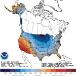
A weak system currently crossing the eastern Plains will move northeastward, but showers will develop during the weekend along the storm’s trailing cold front. Rain could become heavy across the lower Southeast, where totals could reach 1 to 3 inches, while the northern Atlantic region has the potential of experiencing snow by early next week. Colder weather will trail the storm, accompanied by snow showers, especially from the Midwest into the Northeast. Many other areas of the country will remain dry, but precipitation will continue in the Northwest.
Continue reading A major weather pattern shift ahead at Brownfield Ag News.


