National Ag News
Heat wave to ease somewhat on the Plains, eastward
Jul 21, 2017, 17:56 PM
by
System
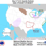
Over the next few days, a series of cold fronts will push across the Midwest and into the South and East. Showers and locally severe thunderstorms will precede and accompany the frontal passages, resulting in 5-day rainfall totals that could reach 1 to 3 inches. Farther west, however, only widely scattered showers will affect the High Plains, including drought-stricken sections of Montana and the Dakotas. Mostly dry weather will also persist in the Pacific Coast States, but monsoon-related showers could result in flash flooding in the Southwest.
Continue reading Heat wave to ease somewhat on the Plains, eastward at Brownfield Ag News.


