National Ag News
Western heat to settle on to the Plains
Jun 30, 2017, 09:04 AM
by
System
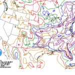
A cold front crossing the Midwest, and eventually the Mid-Atlantic, will continue to generate widespread thunderstorms through Saturday. A subsequent disturbance will result in additional showers early next week across the nation’s mid-section. Five-day rainfall totals could reach 1 to 4 inches across the Midwest and the eastern Plains, but only light showers can be expected on the northern High Plains. Elsewhere, showers will linger through week’s end in the Southeast, while dry weather will accompany a return to hot weather in the Far West, as well as southern Texas.
Continue reading Western heat to settle on to the Plains at Brownfield Ag News.


