National Ag News
Cooler, showery weather to return next week
May 17, 2017, 09:49 AM
by
System
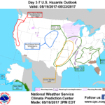
An extremely active weather pattern, featuring heavy rain, severe thunderstorms, and local flooding across the nation’s mid-section, will continue for the next 3 days. During the weekend, rainfall intensity will gradually diminish as showers shift into the South, East, and lower Midwest. Five-day rainfall totals could reach 2 to 5 inches from the southern Plains into the upper Midwest, with 1 to 3 inches possible as far east as the Appalachians. Little or no rain will fall, however, along the Atlantic Seaboard.
Continue reading Cooler, showery weather to return next week at Brownfield Ag News.


