National Ag News
A wet pattern through the next 10 days
Apr 17, 2017, 09:48 AM
by
System
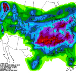
An active weather pattern will continue for the remainder of the week, with each storm system generally moving from west to east but taking a slightly more southerly track across the U.S. For example, a low-pressure system will cross the northern Plains on Tuesday before reaching eastern Canada at mid-week. A subsequent system will traverse the central Plains, lower Midwest, and Northeast during the mid- to late-week period. As the storm track shifts, cool air will gradually settle southward.
Continue reading A wet pattern through the next 10 days at Brownfield Ag News.


